

At nearly 20,000 feet above sea level, where the air thins, the mountains harden into raw sculpture, and the horizon feels impossibly close, a ribbon of road now cuts through the clouds. This is Mig La Pass—India’s newest and highest motorable road, rising to an astonishing 19,400 feet and redefining what’s possible in the high Himalayas.
In October 2025, the Border Roads Organisation (BRO) etched a new chapter in history by unfurling the national flag atop Mig La Pass, overtaking Umling La to claim the title of the world’s highest motorable pass. But Mig La is more than a record-breaking altitude point. It is a triumph of human perseverance over extreme terrain, a vital strategic corridor for India’s border regions, and a powerful symbol of connectivity in one of the most unforgiving landscapes on Earth.
Driving through Mig La Pass is not just a journey, it’s an experience that humbles you. Oxygen levels drop to nearly half of what you breathe at sea level, silence stretches endlessly across barren mountainscapes, and the sheer scale of nature makes every mile feel otherworldly. For adventurers, travellers, and dreamers alike, Mig La Pass represents the ultimate Himalayan frontier.
Quick Facts: Mig La Pass at a Glance
| Category | Details |
| Altitude | 19,400 feet (5,913 meters) |
| Location | Changthang Plateau, Ladakh, India |
| Record | Guinness World Record – Highest Motorable Road (October 2025) |
| Construction | Border Roads Organisation (BRO) under Project Himank |
| Road Name | Likaru-Mig La-Fukche Road (64 km) |
| Construction Period | August 2023 – October 2025 |
| Distance from Leh | Approximately 240-260 km |
| Best Time to Visit | June to September |
| Tourist Access | Expected to open mid-2026 |
| Permit Required | Yes – Inner Line Permit (ILP) |
| Higher Than | Mount Everest South Base Camp (17,598 ft), North Base Camp (16,900 ft) |
The Evolution of World’s Highest Roads: A Brief History
India has consistently held the title for the world’s highest motorable roads, and the journey to Mig La Pass is a story of continuous engineering excellence:
Timeline of Record-Breaking Passes
- Khardung La (18,380 feet) For decades, this iconic pass held the crown and became synonymous with high-altitude adventure in Ladakh. It remains one of the most famous passes among bikers and travelers worldwide.
- Marsimik La (18,314 feet) This lesser-known pass briefly claimed attention before being overshadowed by subsequent developments.
- Umling La (19,024 feet) Opened in 2020-2021, Umling La held the Guinness World Record for approximately four years, becoming a bucket-list destination for adventure enthusiasts globally.
- Mig La Pass (19,400 feet) As of October 2025, Mig La Pass now reigns supreme as the world’s highest motorable road, pushing the boundaries of high-altitude engineering even further.
Mig La Pass Temperature: Extreme Cold Desert
Mig La Pass temperature plummets to -30°C in winter, with summer highs barely reaching 5-10°C daytime. Sub-zero nights persist year-round in this cold desert, where wind chill drops effective temps further amid 50% lower oxygen.
During summer from June to September, daytime temperatures at Mig La Pass range from 0°C to 10°C, while nights drop to -10°C. Monsoon conditions introduce fog and further cooling to around -5°C. In winter, expect daytime highs of -20°C and lows reaching -40°C, when roads become completely ice-bound.
Note* : The UV index remains extremely high year-round despite the cold, so pack strong sun protection like SPF 70+ sunscreen and UV-blocking gear.
Location and Geography: Understanding the Changthang Plateau
Where exactly is Mig La Pass?
Mig La Pass is located on the Changthang Plateau in Ladakh, one of the most remote and challenging terrains on Earth. The pass forms part of the Likaru-Mig La-Fukche road alignment, creating a crucial link between Hanle and the border village of Fukche.
The Landscape
The Changthang region is characterized by:
- High-altitude Cold Desert: Vast, arid landscapes with minimal vegetation
- Dramatic Mountain Ranges: Smaller mountains clustered against massive peaks
- Extreme Weather: Sub-zero temperatures, strong winds, and thin air
- Pristine Environment: Untouched wilderness with unique geological formations
- Wildlife: Home to Tibetan wild ass (kiang), blue sheep, and migratory birds
Neighboring Landmarks

- Hanle Village: 260 km from Leh, home to the Indian Astronomical Observatory.
- Fukche Village: A border settlement just 3 km from the LAC.
- Umling La Pass: The previous record holder at 19,024 feet.
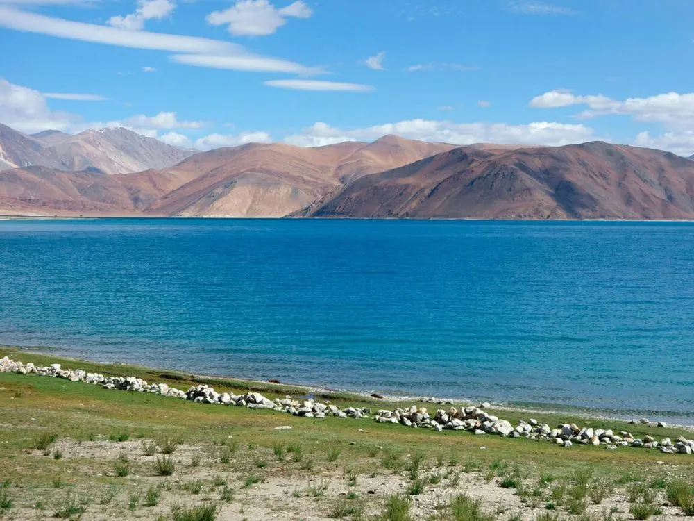
- Tso Moriri Lake: A high-altitude lake in the Changthang region.
- Demchok: A divided village on the Indo-China border.
Why Was Mig La Pass Built? Strategic and Civilian Significance
Strategic Importance
The Likaru-Mig La-Fukche road serves as the third vital axis from the Hanle sector to Fukche village, which is located just 3 km from the Line of Actual Control (LAC) with China. This connectivity is crucial for:
- Military Logistics: Faster movement of troops and supplies to border areas.
- All-Weather Access: Year-round connectivity to strategically important regions.
- Border Security: Enhanced presence and rapid response capabilities near the LAC.
- National Infrastructure: Demonstrating India’s commitment to developing border regions.
Civilian Benefits
Beyond its strategic value, the road brings transformative benefits to local communities:
- Connectivity for Remote Villages: Border villages like Fukche, Koyul, Rongo, and Demchok, which often face complete isolation during harsh winters, now have reliable year-round access.
- Economic Development: Improved infrastructure supports the local economy through better access to markets, medical facilities, and educational institutions.
- Tourism Opportunities: The road opens up new possibilities for adventure tourism, bringing economic benefits to the Changthang region.
- Quality of Life: Residents can now receive medical emergencies, supplies, and essential services even during extreme winter conditions.
How to Reach Mig La Pass: Routes and Travel Planning
Primary Route: Leh → Hanle → Mig La Pass
This is the most common and recommended route for visitors:
Leh → Karu (38 km) → Upshi → Debring (122 km) → Thukje (150 km) → Nyoma (226 km) → Loma (bridge crossing) → Hanle (299 km) → Likaru → Mig La Pass
- Total Distance: Approximately 240-260 km from Leh.
- Travel Time: 8-10 hours (depending on road conditions and acclimatization stops)
- Road Conditions: Generally good, as this is a strategic military route.
Route Description
- Leh to Karu (38 km): Smooth tarmac road along the Indus River
- Karu to Upshi: Gradual ascent into the Changthang region
- Upshi to Nyoma (226 km): Remote stretch with sparse habitation
- Nyoma to Loma: Registration point at Loma before crossing the Indus bridge
- Loma to Hanle (50-70 km): Right turn after bridge, stunning desert landscapes
- Hanle to Likaru to Mig La: Final approach to the pass through the newly constructed road
Alternative Routes (Subject to Permits)

Via Tso Moriri: Some travelers combine Mig La with Tso Moriri Lake visits, though this requires careful planning.
Via Pangong-Chushul Route: An alternative approach from Pangong Tso via Chushul, but permit approvals are uncertain.
Permits and Documentation: What You Need to Know
Inner Line Permit (ILP)
Current Status: As of 2025, Hanle and surrounding areas require an Inner Line Permit for Indian tourists. However, permit regulations have been simplified.
How to Obtain Permits
For Indian Citizens:
- Previously required ILP can be obtained from DC Office or Tourist Information Center in Leh
- Recent policy changes (as of late 2021) have simplified access to many areas in Ladakh
- You must pay the Ladakh Environment Fee online and carry the receipt
Ladakh Environment Fee Breakdown:
- Wildlife Fee: ₹400 per person (one-time)
- Environment Fee: ₹100 per day
- Red Cross Fee: ₹50 (optional)
- Total: Approximately ₹500-1000 depending on duration
Payment Portal: www.lahdclehpermit.in/register-as-domestic
For Foreign Nationals:
- Foreign tourists and OCI cardholders currently cannot visit Mig La Pass or stay overnight in Hanle
- Some areas like Hanle allow day visits only, with mandatory return to Nyoma
- This is due to the proximity to the LAC
Documents to Carry
- Valid Government-issued Photo ID (Aadhar Card, Passport, Driving License)
- Vehicle Registration Certificate (if self-driving)
- Ladakh Ecology Fee receipt
- Inner Line Permit (if required)
- Travel insurance documents (highly recommended)
Best Time to Visit Mig La Pass

Ideal Season: June to September
Summer Months (June-August)
- Temperature: Daytime 10-15°C, Night-time -5 to 5°C
- Road Conditions: All roads open and accessible
- Visibility: Clear skies, excellent mountain views
- Challenges: Peak tourist season, higher accommodation costs
- Why Visit: Most comfortable weather, safest road conditions
Early Autumn (September)
- Temperature: Daytime 5-10°C, Night-time -10 to 0°C
- Road Conditions: Still accessible, but weather can be unpredictable
- Visibility: Crystal clear skies, fewer tourists
- Challenges: Cold nights, some hotels start closing
- Why Visit: Off-season tranquility, better photography light
Seasons to Avoid
Winter (October-March)
- Roads closed due to heavy snowfall
- Temperatures plummet to -30°C to -40°C
- Extreme risk of frostbite and hypothermia
- Limited rescue and medical facilities
- Not recommended even for experienced travelers
Pre-Summer (April-May)
- Snow clearance still underway
- Unpredictable weather patterns
- Risk of sudden snowfall blocking roads
- Limited tourist infrastructure operational
Planning for a Ladakh Bike Trip that goes beyond the usual routes? Check out our Leh Ladakh Bike Trip With Mig La Pass
What to Pack: Essential Gear for Mig La Pass
Clothing Layers (Most Important)
Base Layer (Inner):
- Thermal innerwear (top and bottom)
- Moisture-wicking synthetic or merino wool
- Pack 2-3 sets
Mid Layer (Insulation):
- Fleece jacket or pullover
- Down jacket (700+ fill power)
- Insulated pants
Outer Layer (Protection):
- Windproof and waterproof jacket
- Rain pants or shell pants
- Quality matters – don’t compromise here
Extremities:
- Woolen socks (3-4 pairs)
- Thermal gloves + waterproof outer gloves
- Balaclava or woolen cap covering ears
- Neck warmer or scarf
- Sunglasses (UV protection mandatory – Category 4)
- Face mask for dust and wind
Footwear:
- Waterproof trekking boots with ankle support
- Thermal insoles
- Camp shoes or sandals for breaks
Equipment and Gear
Mandatory:
- Sturdy backpack (40-50L)
- Water bottles (2-3 liters capacity) + thermos
- Sunscreen (SPF 50+) and lip balm
- Power bank (fully charged)
- Headlamp with extra batteries
- Plastic bags (keep gear dry)
Highly Recommended:
- Portable oxygen cylinder (available for rent in Leh)
- Sleeping bag (if camping, -15°C rated minimum)
- Trekking poles (help with stability)
- Camera with extra batteries (cold drains batteries fast)
- Binoculars (for wildlife and views)
Optional but Useful:
- GPS device or downloaded offline maps
- Emergency whistle
- Multi-tool or Swiss knife
- Portable toilet kit (minimal facilities on route)
Food and Snacks
- Dry fruits and nuts
- Energy bars and chocolate
- Instant noodles or soup packets
- Biscuits and crackers
- Electrolyte powder sachets
- Glucose or energy drink powder
- Ginger candies (help with nausea)
Tips and Critical Reminders
- Never skip acclimatization days.
- Carry oxygen and altitude medication Keep summit visits brief (30-60 minutes maximum)
- Descend if symptoms appear
- Respect the environment and local communities
Mig La Pass represents the pinnacle of high-altitude adventure. This engineering marvel offers unparalleled views and the prestige of standing at the world’s highest motorable point. However, it demands respect, preparation, and adherence to safety protocols.
The journey is not just about reaching 19,400 feet; it’s about experiencing one of Earth’s most pristine and extreme environments. Proper acclimatization, realistic expectations, and environmental responsibility are essential for a safe and memorable adventure.
Some roads aren’t just driven, they’re felt.
Where silence is louder than engines and the sky feels closer.
So, are you ready to conquer one of Ladakh’s wildest roads – Mig La Pass?


