


Are you seeking a challenging trail in Himachal that blends with spirituality and extreme adventure? Are you a devoted follower of Lord Shiva? Do you want to experience the adventure that tests your limits while rewarding you with divine views? If any of these questions made sense to you, then the Shrikhand Mahadev Trek in Himachal Pradesh is calling you.
Named after Lord Shiva, Shrikhand Mahadev is one of the most sacred pilgrimage treks in India that leads to the 5,227-meter (17,150 feet) Shrikhand Mahadev peak. The massive 75-foot Shivalingam sits amidst snow-covered Himalayan ranges, offering a surreal, divine experience to all who reach the summit.
Part of the revered Panch Kailash (Five Kailashas), Shrikhand Mahadev is considered the third most significant peak after Mount Kailash and Adi Kailash. The other holy peaks include Kinnaur Kailash, Manimahesh Kailash, and Adi Kailash.
From the summit, trekkers can witness views of the Sutlej River, Kinnaur ranges, Hansbeshan range, Kullu Himalayas, Jorkandan, Rangrik, and many other majestic peaks that form the backdrop.
There are two trekking routes to Shrikhand Mahadev — one from Arsu and another from Nirmand. However, the most popular route starts from Jaon village, located in the Kullu district of Himachal Pradesh.
Thinking of Taking the Trek? Here’s What You Should Know
Before you embark on this sacred yet challenging journey, it’s important to understand the terrain, elevation, and logistics involved. The Shrikhand Mahadev Trek is not just physically demanding but also requires serious preparation and acclimatization.
About Shrikhand Mahadev Trek: Altitude, Route & Base Camp Info

If you are planning Shrikhand Mahadev Trek, there are some key facts that you should be aware of like the shrikhand mahadev trek distance, shrikhand mahadev height, altitude, elevation, best time for shrikhand mahadev trek etc.
- Altitude: 5,227 meters / 17,150 ft.
- Trail Type: Very challenging – includes steep inclines, boulder fields, and glacier crossings.
- Railhead: Shimla (170 km from Jaon). Connected to Kalka via narrow-gauge railway.
- Road Access: Buses from Shimla ISBT to Rampur (130 km), then via Nirmand to Jaon. The last 8 km from Bagi Pul to Jaon is a rough road.
- Base Camp: Jaon Village or Singhgad
Where is Shrikhand Mahadev Trek Located?

One of the most frequently asked questions we get is — where exactly is the Shrikhand Mahadev Trek located? Located in the Kullu region of Himachal Pradesh, Shrikhand Mahadev Trek goes through villages of Himachal giving the trekkers a complete essence of Himachali life.
The Jorkandan and Rangrik ranges of Kinnaur, the Kullu range, Hansbeshan, and other nearby peaks in the southeast of the Satluj river are visible when traveling to the Shrikhand Mahadev Yatra.
History and Significance of Shrikhand Mahadev Trek

The boulders and landscape of Shrikhand Mahadev hide a mythological story that is deeply rooted in Hindu tradition. Shrikhand Mahadev is not simply a Shiva Temple that you will find. It holds a story of spiritual importance within it. The legend goes on like this. According to Hindu mythology, Lord Shiva spent a very long time meditating here. It is also thought to be the entrance to Kinner Kailash, a magical place.
Many people think that this journey is as much a spiritual as a physical test, and that only those who are truly called by Shiva can finish it. The path represents stepping away from the material world and toward the divine.
The other story is related to Ramayana. Ravana, the demon king is said to have performed deep penance here. The name Srikhand comes from Sir Khandan. In order to appease Lord Shiva, he would cut his head as an offering, and eventually, Lord Shiva granted Ravana immortality.
Another legend states that Bhasmasur was blessed by Lord Shiva with the ability to turn anyone into ashes. Bhasmasur tried to destroy Bhole Baba by taking advantage of this.
On top of this massive rock, now known as Shrikhand Mahadev Shivling, Lord Shiva took samadhi after escaping through Devdhank. Later, after Mata Parvati and their offspring, Lord Kartikeya and Lord Ganesh, went through a trying time, Lord Shiva came out of this. On the Shrikhand Kailash Peak, the fissures are still visible.
Book Your Shrikhand Mahadev Trek with JustWravel HERE….
Shrikhand Mahadev Trek Route, Distance & Difficulty Level
The Shrikhand Mahadev Trek can be attempted from three major access points:
- Nirmand in Kullu district
- Fancha in Shimla district
- Banjar in Kullu
Among these, the Fancha route for Shrikhand Mahadev Trek is considered the toughest and most demanding, recommended only for seasoned trekkers. The most popular and safest route begins from Nirmand, passing through Bagipul, Jaon, Taacharu, and Nainser before reaching the summit.
Trekkers can hire local guides and porters from Nirmand or Bagipul if needed. While not mandatory, hiring support can enhance safety and ease, especially for those unfamiliar with high-altitude terrain.
The trek spans approximately 32 to 35 kilometers one way, with the maximum elevation being 5,162 meters at Shrikhand Mahadev Peak. The trail is physically demanding and requires good fitness and preparation.
The trek is graded Moderate to Difficult, featuring long, steep ridge walks and demanding ascents. The total trek distance is around 60-70 km (30-35 km one way). In June and early July, trekkers expect to walk over firm snow, while in autumn, trekkers must navigate steep and rocky sections.
There is no requirement for special permits for Shrikhand Mahadev Trek, making it more accessible in terms of logistics.
Total Trek Distance and Route Map
The total trek distance for Shrikhand Mahadev is approximately 32–35 kilometers (one way) from Jaon village. The route passes through key stops like Singhaad, Thachdu, Kali Ghati, and Bheem Dwar before reaching the summit.
The trek usually takes 5 to 6 days, depending on the fitness level and acclimatization.
Here’s a simplified route overview:

Why Shrikhand Mahadev Trek Is Considered One of the Toughest Himalayan Treks

The Shrikhand Mahadev Trek is one of the most challenging high-altitude pilgrimages in India. Several factors contribute to its difficulty:
High Altitude of 5,200 Meters and Risk of AMS
The trek reaches an elevation of approximately 5,200 meters (17,060 feet). At this height, oxygen levels are significantly lower, increasing the risk of Acute Mountain Sickness (AMS). Reduced oxygen also makes physical activity more exhausting, especially for those not properly acclimatized.
Steep Climb and Challenging Terrain Conditions
Trekkers encounter steep ascents, rocky paths, slippery boulders, and narrow ridges—particularly around Kali Ghati. The route also includes glacial crossings, rough moraines, and snow-covered sections depending on the season. These terrains require good balance, sturdy gear, and strong legs.
Long Trekking Distance of 65–70 KM Round Trip
The entire trek spans about 65–70 km round trip, though some routes may extend to 70–100 km depending on the path taken. It typically takes 5–7 days to complete. Continuous elevation gain, long walking hours, and back-to-back trekking days demand sustained stamina and endurance.
Unpredictable Weather and Harsh Climate
Weather conditions in the higher Himalayas can change rapidly. Even during July and August, trekkers may face sudden rain, snowfall, fog, or freezing temperatures. Exposure to cold winds, storms, or heavy rainfall is common, and proper gear is essential to cope with these challenges.
Limited Facilities and Remote Trail Route
The trek passes through remote regions with very limited or basic facilities for food, shelter, and rescue support. Emergency medical help or rescue services are minimal, and mobile connectivity is often unavailable.
Physical and Mental Endurance
The demanding trail tests both physical fitness and mental resilience, as the trek can be exhausting, and trekkers must keep up their motivation and composure under strain. Fatigue, muscle soreness, and even minor injuries are common, so a strong mindset is essential.
Limited Trekking Season in July and August
The Shrikhand Mahadev trail is accessible for only a limited time — mostly during July and early August, when the snow melts and conditions are relatively safe. This short safe window demands careful planning and preparation.
Best Time to Visit Shrikhand Mahadev

The ideal season for the Shrikhand Mahadev Trek is during July to August, which also aligns with the official Yatra season. The 32 km trail is only accessible in this short window due to extreme weather conditions in other months.
|
Season |
Months |
Weather Conditions |
Trekking Activity/Accessibility |
|
Summer |
April to June |
Mild temperatures; residual snow and unstable trails. |
Trekking is not recommended; no official Yatra. |
|
Monsoon (Yatra Season) |
July to August |
Rainy season; weather relatively stable in the region during this period. |
Official Yatra season—Shrikhand Mahadev Yatra happens; 32 km trek by devotees. Trekking is popular despite rain, and requires caution. |
|
Winter |
October to March |
Extreme cold and heavy snowfall |
Trek not possible; route remains shut |
Shrikhand Mahadev Weather Conditions

You can expect cold and windy conditions throughout the trek. Night temperatures can drop below freezing, and snowfall at Shrikhand Mahadev Peak is always a possibility—even during the trekking season. It’s essential to carry sufficient warm and waterproof clothing.
Wildlife and Natural Beauty on the Shrikhand Mahadev Trail
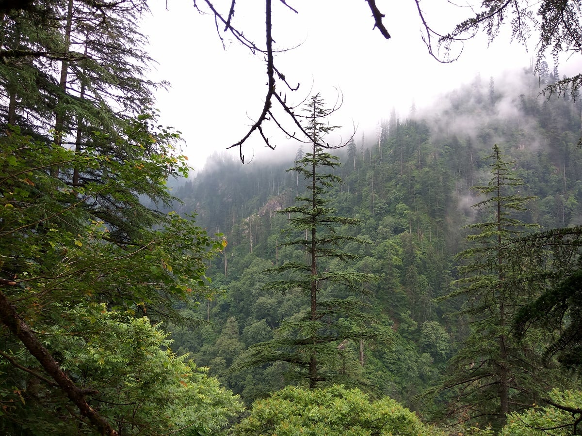
The Shrikhand Mahadev trek passes through diverse ecological zones due to its significant altitude variation. In the lower sections, you can find lush pine and oak forests that provide shelter for wildlife such as barking deer and Himalayan birds.
As the elevation increases, the vegetation transitions to rhododendrons and sparse alpine shrubs. At higher altitudes near the snowline, flora becomes scarce, but the area still supports hardy mosses and lichens.
Trekkers may encounter Himalayan marmots, snow partridges, and mountain goats in the upper regions. The rich biodiversity adds an enriching natural aspect to the spiritual and physical journey of the trek.
How to Reach Shrikhand Mahadev Base Camp (Jaon Village)

Jaon Village, located in the Kullu district of Himachal Pradesh, serves as the base camp for the Shrikhand Mahadev Trek. This remote village is accessible via road and is connected through a network of buses and taxis.
To reach Jaon, you can take the Delhi → Chandigarh → Shimla → Rampur → Jaon route. From Rampur, you’ll cross the Satluj River to enter the Nirmand region, continuing your journey to Jaon. The village is around 167 km from Shimla.
Nearest Airport to Shrikhand Mahadev
- The nearest airport is Chandigarh Airport, located around 260 km (approx. 9 hours) from Jaon.
- Regular flights operate between Chandigarh and major Indian cities.
- From the airport, travelers can either take a bus or hire a taxi to reach Jaon village, the starting point of the Shrikhand Mahadev Yatra.
Nearest Railway Station
- The closest railway station is Chandigarh, about 250 km (approx. 8 hours) from Jaon.
- Alternatively, Kalka Railway Station is another option at 230 km distance.
- From either station, taxis and buses are available to continue the journey toward Rampur and Jaon.
Road Connectivity & Bus Routes
- Himachal Roadways and private buses run regularly between Delhi–Shimla and Chandigarh–Shimla.
- From Shimla, board a bus to Rampur, and then continue to Jaon village via Nirmand.
- Direct buses to Jaon or Nirmand are also available from Shimla’s local bus stand.
- From Chandigarh (airport or railway station), shared and private taxis are readily available.
Complete Trek Route Path:
Chandigarh — Jaon Village — Singhgad — Thachru — Parvati Bagh — Nain Sarovar — Shrikhand Mahadev Peak — Return via the same route — Chandigarh is the path we take for the Shrikhand Mahadev.
Accommodation and Food Options on Shrikhand Mahadev Trek
During the Yatra season, basic tented accommodations and simple vegetarian meals are available at key halting points like Thachdu (Taacharu), Kunsa, Bhima Dwar, and Parvati Bagh.
- Tent charges may range from ₹300–₹600 per night depending on location and demand.
- Carrying your own trekking tent, sleeping bag, and dry snacks is recommended for self-sufficiency.
- Water is usually sourced from natural streams; carry purification tablets.
Pro Tip: The area lacks permanent hotels or guesthouses—temporary tents and community kitchens serve most needs.
Mobile Network and Last ATM Service in Shrikhand Mahadev Trek

Mobile network coverage is very limited on the Shrikhand Mahadev trek due to the remote and rugged terrain. Most trekkers lose connectivity soon after leaving the base village, with no reliable service available beyond key checkpoints like Jaon village or Thachdu.
It is advisable to inform family and emergency contacts before starting the trek, as real-time communication during the journey may not be possible.
The last ATM and banking facilities are typically available in local towns like Nirmand or Jaon, which serve as last stops for replenishing cash before the trek. Trekkers should carry sufficient cash, as no ATMs or digital payment options exist en route or at base camps.
Major Camps of Shrikhand Mahadev Trek

The Shrikhand Mahadev trek spans approximately 32 km one way from Jaon village to the peak, reaching an altitude of 18,570 feet. This sacred yatra route passes through multiple high-altitude base camps, each offering unique experiences and spiritual significance.
Here’s a breakdown of the major camps and elevation changes along the trek:
Jaon to Singhaad (3 km)
The trek begins at Jaon village, the official base camp of Shrikhand Mahadev. After a 3 km moderate walk, trekkers reach Singhaad, where free meals (Langar) and paid food stalls are available. It’s the last point with semi-reliable phone signals.
Singhaad to Thaachru (12 km – via Dandi-Dhaar)
This is the toughest climb of the trek — a steep ascent through Dandi-Dhaar, which has a near 70° incline. The trail is surrounded by Deodar forests and small streams. After a tough 12 km ascent, trekkers usually halt at Thaachru, where tents and food are available.
Thaachru to Kali Ghati (3 km)
A short yet steep climb from Thaachru leads to Kali Ghati, believed to be the abode of Goddess Kali. On clear days, you can spot the first glimpse of the Shrikhand Shivling.
Kali Ghati to Bheem Talai (1 km)
A downhill walk leads to Bheem Talai, a small forest clearing that serves as a brief resting stop.
Bheem Talai to Kunsa Valley (3 km)
The trail continues through a scenic stretch to Kunsa Valley, blooming with Himalayan wildflowers, fresh air, and panoramic views of the surrounding mountains.
Kunsa Valley to Bheem Dawaar (3 km)
The path continues for another 3 km to Bheem Dawaar, an important campsite providing food and accommodation.
Bheem Dawaar to Parvati Bagh (2 km)

Next comes Parvati Bagh, a beautiful flower meadow said to be planted by Goddess Parvati herself. Here, you may spot Brahma Kamal, the sacred flower tied to Lord Shiva and Ganesha.
Parvati Bagh to Nain Sarovar (2 km)
Trekkers then ascend to Nain Sarovar, a glacial lake held sacred by pilgrims. Many believe that bathing here brings healing and blessings.
Nain Sarovar to Shrikhand Mahadev Peak (3 km)
The final 3 km stretch is the most challenging section, involving a steep, rocky climb to Shrikhand Mahadev Peak, where the sacred Shiva Lingam stands. Behind it rises a smaller peak said to be dedicated to Lord Kartikeya.
Essential Packing List for Shrikhand Mahadev Yatra – Gear & Clothing Guide

Proper packing is critical for a safe and successful Shrikhand Mahadev trek. Due to the high altitude, unpredictable weather, and remote terrain, trekkers must carry essential gear and personal items across multiple categories.
Below is a detailed checklist to help you prepare effectively:
Backpack
- Trekking Backpack (40–60L)
Sturdy, comfortable straps. With rain cover (essential). - Daypack (20L)
For personal items like water and snacks if the main bag is offloaded.
Clothing – Layers
- Trekking Pants (2 pairs)
Avoid jeans; opt for cotton or quick-dry fabrics. - Full-Sleeve T-Shirts (2)
Prefer lightweight with sun protection. - Fleece Jackets (2)
Essential for warmth during camp nights. - Padded Jacket (1)
Insulated for higher altitudes. - Thermals (1 set)
Optional unless you’re sensitive to cold. - Nightwear Set (1)
For sleeping comfort. - Raincoat/Poncho
Full-body coverage should protect your backpack too. - Woolen Cap, Gloves, Neck Warmer
One each – crucial for high-altitude cold. - Sun Cap
To protect during daytime hikes. - Socks (5–6 pairs + 1–2 woolen)
Include quick-dry pairs. - Innerwear
Sufficient for the trek duration.
Footwear
- Trekking Boots
High-ankle, strong grip. Avoid sports shoes. - Sandals/Slippers
For use around campsites. - Extra Laces (1 pair)
- Gaiters (optional)
Useful for snow or muddy sections.
Accessories
- Sunglasses (UV Protected)
Prevents snow blindness. - Headlamp/Torch + Spare Batteries
Must-have for navigating in the dark. - Trekking Pole
Helps in steep/uneven terrain. - Water Bottles / Hydration Pack (Min 2L)
- Tiffin Box, Mug, Spoon
For meals during the trek. - Quick-Dry Towel (1)
- Power Bank / Extra Batteries
- ID Proof & Passport Photos
Carry originals and 2–3 copies.
Personal Care
- Sunscreen (SPF 30+), Lip Balm, Moisturizer
For harsh sun and dry air. - Cold Cream
For face and hands. - Toiletries
Toothbrush, toothpaste, toilet paper, paper soap, hand sanitizer. - Sanitary Products
As per personal needs.
Food & First Aid
- Energy Snacks
Glucose, dry fruits, energy bars. - ORS & Glucose Sachets
Useful for hydration and fatigue. - Basic Medicines
Painkillers, Diamox, muscle spray, personal meds, band-aids. - First Aid Kit
Outdoor Gear
- Sleeping Bag (if not provided)
Personal one ensures hygiene. - Sleeping Mat (optional)
- Waterproof Pouch
Store documents, devices safely.
Miscellaneous
- Camera + Extra Batteries
- Polythene Bags: Useful for dirty/wet clothes.
Documentation
- Medical Fitness Certificate – Mandatory
- Insurance Policy – Optional but recommended
Pro Tip: Always pack light but smart. Double-check weather conditions before departure and test your trekking gear beforehand for comfort and fit.
Shrikhand Mahadev Yatra Registration & Guidelines

The Shrikhand Mahadev Yatra is organized annually by the Kullu District Administration in collaboration with the Shrikhand Mahadev Yatra Trust. This spiritual trek leads pilgrimage through scenic alpine meadows to reach the sacred Shivlinga atop the Shrikhand Kailash mountain.
Registration Requirements:
- Mandatory Registration: All pilgrims must register before undertaking the yatra.
- Eligible Age Group: Only individuals between 18 and 60 years are allowed to participate.
- Medical Fitness: A valid medical certificate is required. The trail is physically demanding and not suitable for people with heart conditions or physical disabilities.
- Registration Fee: A non-refundable fee of ₹200–₹300 is applicable. Even if a participant is declared unfit during the medical screening at Singhaad Base Camp, the fee is not reimbursed.
Shrikhand Mahadev Yatra Dates:
- 2025 Dates: The Shrikhand Mahadev Yatra 2025 is expected to take place between July 20 and August 5, 2025, depending on weather conditions and administrative updates.
- 2026 Tentative Dates: Likely to fall between the third week of July and the first week of August, subject to final confirmation by the authorities.
How to Prepare for Shrikhand Mahadev Trek
The Shrikhand Mahadev Trek is physically demanding, proper preparation is essential to complete the yatra safely and enjoyably.
Build Stamina and Endurance
Start training at least 2–3 months before the Shrikhand Mahadev trek. Focus on boosting cardiovascular endurance through activities like:
- Brisk walking, jogging, cycling, or swimming for 30–40 minutes, 4–5 times a week.
- Combine with strength training that targets:
- Legs – squats, lunges, calf raises
- Core – planks, crunches
- Back – superman pose, bridges
This conditioning helps you tackle long climbs and uneven sections without overexertion
Improve Flexibility and Balance
Improve your flexibility to reduce injury risk, especially in high-altitude and rocky stretches.
- Stretch key muscle groups daily—hamstrings, calves, quads, back, and shoulders.
- Include yoga or Pilates in your routine to build balance, core strength, and joint mobility, which are essential for walking on slippery, narrow trails and crossing boulders or glaciers.
Safety Tips for Shrikhand Mahadev trek
- Ascend gradually to allow your body time to acclimatize to the high altitude.
- Stay hydrated — drink plenty of water throughout the trek.
- Learn about Acute Mountain Sickness (AMS) and its symptoms like nausea, dizziness, or headache.
- Carry essential medications for altitude sickness, cold, and a basic first-aid kit.
- Maintain a balanced diet for better stamina and recovery: include carbs for energy, proteins for muscle repair, and fruits/veggies for nutrients.
- Avoid alcohol and smoking before and during the trek as they affect oxygen absorption and acclimatization.
- Obtain a medical fitness certificate from your doctor before starting the trek.
- Consider buying travel or accident insurance that covers high-altitude trekking.
- Keep buffer days in your itinerary to account for weather delays or rest days.
- Inform a friend or family member about your trek plan and keep emergency contact numbers handy.
Shrikhand Mahadev Trek – From Experience of a Trekker

Mahadev — the Supreme Being, the destroyer of evil, another name of Lord Shiva. Among the sacred mountain ranges believed to be his dwelling, the Himalayas hold a divine place in Hindu mythology. There are several places in and around India which are linked to Shiva and his stories such as Kailash Mansarovar, Kinner Kailash, Amarnath, etc. All these destinations are considered highly sacred and quite hard to reach.
Out of all, one such place is Shrikhand Mahadev. A towering Shivling, naturally formed at 18,570 ft above sea level, marks the final destination of this pilgrimage. The Shrikhand Mahadev Trek is more than a hike—it’s a spiritual yatra that tests not just physical endurance but also devotion. Recognized as one of the toughest pilgrimages in India, it involves a total trekking distance of approximately 70 km (round trip) completed over 5 days.
The yatra begins from Jaon village in Himachal Pradesh, guiding devotees and trekkers through dense forests, alpine meadows, waterfalls, and glacial moraines before culminating at the towering Shivling of Shrikhand Mahadev — believed to be an embodiment of Lord Shiva himself.
Day 0 – Prepping for the Trek
When you are leaving for a 5-day trek, you are bound to be excited about the same; the same was with me. After a hectic day at the office, I just couldn’t wait to leave for the Shrikhand Mahadev Trek. It was my first high-altitude trek, so I was a little more excited about it. I left early from the office just to cross-check my backpack to ensure I had packed everything as required. It was going to be a tough trek, so I had to keep myself prepared both physically and mentally.
My bus was at 10:30 in the evening for Shimla, so I reached ISBT just in time to board it.
Day 1 – Shimla to Jaon
I reached Shimla at 6:30 in the morning at ISBT, where I was greeted by Nettu, my co-traveler and guide for the Shrikhand Mahadev Trek. A local who had done this trek many times before, along with other high-altitude treks.
We started our journey at 7:30 AM from Shimla, joined by Amit, who was headed to Kinnaur Kailash with another group. It took around 5 hours to reach Rampur. From there, Amit dropped us at the Rampur bus stand, and we took a local bus to Jaon (50 km), which took another 3 hours due to frequent stops.
After buying a few essentials from Jaon, we started the 4 km trek to Singhad, the last inhabited village on this route. Beyond that, it’s all pitched tents, langars, and temporary shops. The trail was mostly level and took us around 90 minutes to reach Singhad, where we halted for the night.
Day 2 – Jaon to Thachru (12 km Trek)
We started at 7:30 AM from Singhad after having tea at the langar where we stayed the night. The 4 km stretch from Singhad to Barathi Nala runs along the river with a few hill crossovers — a good warm-up before the real challenge begins.
We had breakfast at a langar in Barathi Nala — aloo paratha and tea, served daily to devotees for over 12 years. That meal was important; we needed the energy for what lay ahead.
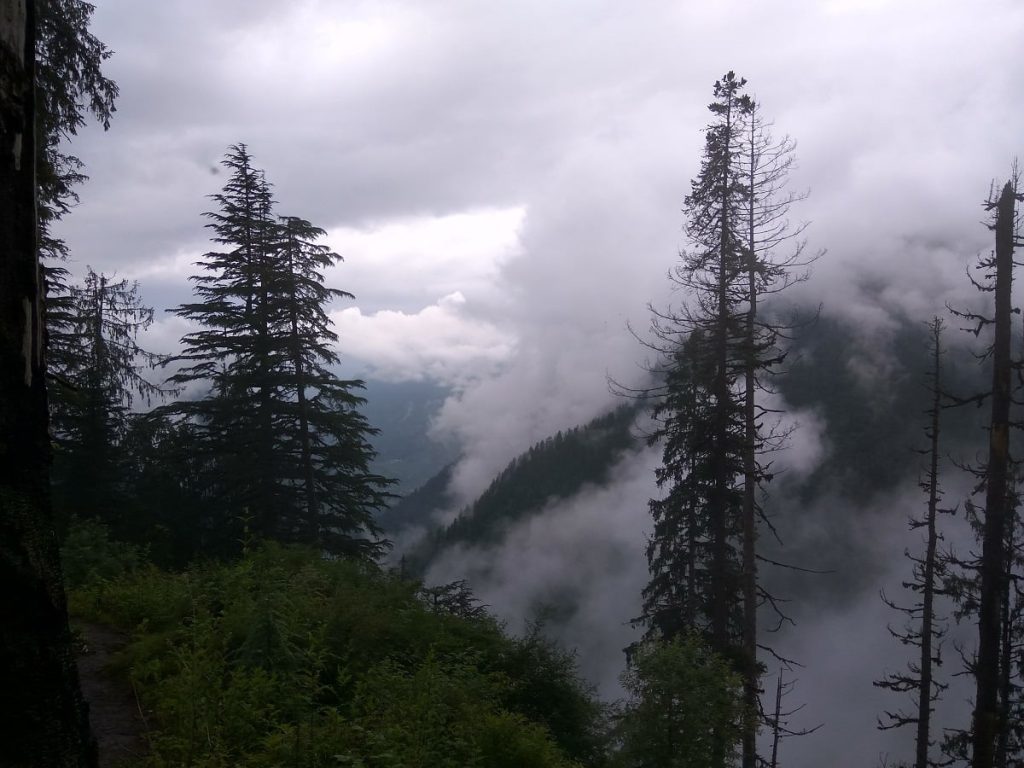
The trail ahead was a steep climb through the forest. Continuous drizzle made it slippery and slushy, and we had to tread carefully across small boulders. At times, the clouds cleared up, revealing valleys and distant peaks — perfect spots to pause and take it all in. I often sat and thought, “What next?”
Every hour or so, we found a small shop to grab something to eat or drink. But it’s best to carry at least 2 litres of water with you.
Reaching Thachru before sunset was the goal, and we made it on time. After nearly 7 hours of walking, with several breaks for food and rest, we reached by 5 PM.
It was tiring — not as bad as I imagined — but just the beginning. We pitched our tents next to a shop, with the owner’s permission. By evening, we were above the clouds, settled in, and soaking it all in.
Later, we went for a short walk around the area. Everything felt new — surreal. It was my first high-altitude trek, and I was simply absorbing it all.
Day 3 – Thachru to Bhim Dwar via Kali Ghati (4050 mts)
The day started with a light breakfast at Thachru. We left around 9 AM, and though the climb began steep, it gradually became easier compared to the previous day. The route to Kali Ghati was open, without any tree cover, and we reached the top in about 2 hours.
Thankfully, the weather was in our favor—cloudy and cool—which made the climb more bearable. From Kali Ghati, the trail kept changing. We crossed small hills, gentle slopes, and valleys, soaking in views that felt new at every turn.
By evening, around 5 PM, we reached Bhim Dwar. Same routine—pitched our tents beside a shop, unpacked, and went out for a walk.
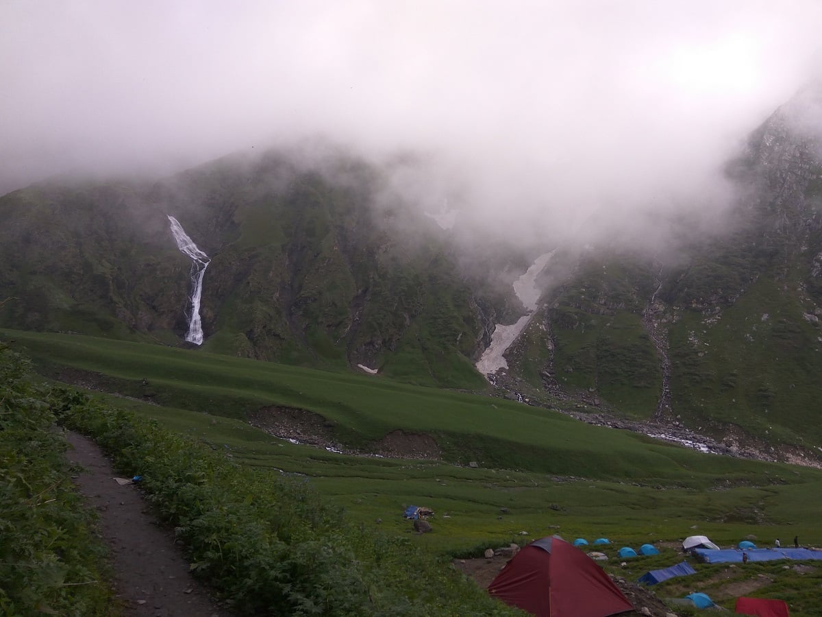
But Bhim Dwar felt different. Huge waterfalls on either side, a wide open valley, and just for a few moments, the clouds lifted to reveal Shrikhand Mahadev Peak. Towering. Silent. Grand. It felt like we were finally close.
That night, we went to sleep early. The summit was next, and at 18,593 feet, I knew it wouldn’t be easy.
Day 4 – Bhim Dwar to Shrikhand Mahadev Peak and Back (5300 mts)
Today was the big day — the summit day. From Bhim Dwar (around 3800 mts) to Shrikhand Mahadev Peak (5300 mts) and back, it was going to be a long and challenging trek with a steep altitude gain.
We started at 5:30 AM, although the original plan was to begin at 4. It’s always better to trek early — once the sun rises, it gets warmer and you start losing energy.
The first stretch from Bhim Dwar to Parwati Baag was a 3 km vertical climb, and it took me almost 2 hours to reach. Parwati Baag is a wide valley on a hilltop, spread over acres with flower-covered shrubs everywhere. It was a beautiful sight — one I’ll never forget. After every steep climb, the view was the real reward. It made me forget all the pain and fatigue.

From there, we crossed a glacier to reach Nain Sarovar, a tough and boulder-filled walk that took 90 minutes. The final approach to Nain Sarovar, at around 4300 mts, was steep and rocky.
As the name suggests, Nain Sarovar (Nain = Eye, Sarovar = Lake) is believed to have formed from a tear of Goddess Parvati while she was searching for Lord Shiva. The lake itself wasn’t big but was mostly frozen and snow-covered.
Beyond this, the real test began.
There were multiple hilltops, glaciers in between, and the altitude kept rising. According to locals, the spot where Bhim placed stones to reach heaven is nearby — and the landscape really looked like stacked stones. Some stones even had engravings known as “Bheem Lipi.”
After 4 hours of tough trekking, I finally reached the Shrikhand Mahadev peak. A few times, the sky cleared mid-way, and glimpses of the peak gave me a fresh boost of energy. With chants of “Har Har Mahadev,” “Bam Bam Bhole,” and “Jai Bhole Nath” echoing around, it was an emotional and powerful moment. Something I hadn’t felt before.
Reaching the top was a feeling like no other. After days of trekking, tents, and sleeping bags — just being there was surreal. I sat silently, just taking it all in. The weather cleared and we were lucky to see the entire valley and the surrounding peaks. One of the peaks was Kartikeya Peak, believed to be Lord Shiva’s son.
Though I wanted to stay longer, we had to head back to Bhim Dwar. The descent was no easier — glacier crossings, slippery patches, and wet terrain due to occasional rain. By the time I reached Nain Sarovar, the rain had started again, making it more slippery and slow.
Despite the challenges, the day was unforgettable — a mix of devotion, endurance, beauty, and peace.
Day 5 – Bhim Dwar via Thachru to Singhad
After successfully completing the Shrikhand Mahadev summit, it was time to begin our return journey. The plan was to cover 24 km from Bhim Dwar to Singhad in a single day — a long and tiring stretch, but doing it would save us a full day and get us back to network and work sooner.
We started at 7 AM, packed our bags early, and began the descent. We knew it had to be a pacy trek, and we occasionally switched bags to help each other out.
After an intense 12-hour trek, we finally reached Singhad by 7 PM. It was exhausting, but a satisfying end to a truly rewarding experience.
We freshened up and changed our clothes. Thankfully, we were staying at the same langar where we had spent our first night when we started the trek — a full-circle moment to wrap up the journey.
Day 6 – Back to Shimla and Home
The final day of our Shrikhand Mahadev trek, and it really felt like it. We were super lazy, got up late — well, 7:30 AM, which felt late after days of early starts. Since our bags were already packed the night before, we didn’t have much to do in the morning.
We left Singhad by 9, had a quick breakfast at one of the langars, and started our descent toward Jaon.
At Jaon, we had an unexpected stroke of luck — we met Amit Bhai, whose phone had been off. We had no clue how we’d get back to Shimla, but there he was! He had just returned from the Kinner Kailash Yatra with a group and had stopped by Jaon out of curiosity. We truly couldn’t believe our timing.
We left Jaon at noon and reached Shimla by 7 PM. My bus to Delhi was at 9 PM, so the timing worked out perfectly. I boarded the HRTC bus and reached Delhi by 5:30 in the morning.
Looking back, I knew this was one of the toughest treks, and yet I’m amazed at how well my body handled it. Carrying a 20 kg backpack for 5 days wasn’t something I thought I could do — but I did, and it didn’t even feel that exhausting.
The views, the weather, and the people — it was all just perfect. I had never seen so many Shiv Ji bhakts together under one roof. Listening to the babas, seeing people do the trek barefoot, talking to local boys who do the yatra in just 2 days — literally running like shooters — it was inspiring.
Simply great. Simply admirable.
FAQs – Shrikhand Mahadev Trek

What is the total distance and duration of the Shrikhand Mahadev trek?
The trek is around 32–35 km one-way from Jaon to the peak (approx. 64–70 km round‑trip) and typically takes 5–6 days, including acclimatization.
What is the altitude of Shrikhand Mahadev peak?
The sacred Shivling sits at about 5,227 meters (17,150 feet) above sea level.
How difficult is the Shrikhand Mahadev trek?
The trek is classified as difficult to strenuous, involving steep ascents, rocky and glacier-covered paths.It’s considered one of the toughest pilgrim treks in India.
What is the best time to visit or do the Shrikhand Mahadev trek?
The ideal time is the monsoon period between mid-July and August when the official Yatra takes place and weather is relatively stable. The trek is generally accessible from June to September.
How do I reach Shrikhand Mahadev trek starting point?
The trek usually starts from Jaon village in the Kullu district. To get there, you can travel via Shimla or Rampur, with Shimla being the nearest railhead and Jaon accessible by road from Rampur and Nirmand.
What is the distance from major cities like Delhi and Chandigarh to Shrikhand Mahadev?
From Delhi to Jaon village, the distance is about 550–600 km, and from Chandigarh to Jaon, it is approximately 250–280 km by road.
Do I need registration or permits for the Shrikhand Mahadev Yatra in 2025?
Yes, registration is mandatory for the official yatra along with a medical fitness certificate. The registration window typically opens in early July.
What is the approximate cost or budget for the Shrikhand Mahadev trek?
The trek cost varies depending on guides, transport, accommodation, and food. A typical budget ranges from ₹10,000 to ₹20,000 INR per person for the entire trek including permits, food, and guide fees.
What kind of weather and temperature should I expect during the trek?
Daytime temperatures vary from 10°C to 30°C, while nights can be cold, dropping to 2°C to 10°C or even lower near the summit. Weather can change suddenly, especially in the upper reaches.
Is the trek suitable for beginners?
No, the trek is not recommended for beginners or those without prior high-altitude trekking experience, due to its difficult gradients, altitude, and rough glacier terrain.
What is the spiritual significance of the Shrikhand Mahadev trek?
The trek leads to a naturally formed Shivling Shiva peak revered as the “Kailash of the North,” attracting devotees during the annual yatra who seek blessings from Lord Shiva.
Is mobile network available on the trek?
No, mobile connectivity is limited beyond Jaon/Singhad. Don’t rely on it — plan to be offline for most of the trek.
Where is the last ATM or banking facility before the trek?
The last ATMs and banking services are in Rampur or Nirmand. Carry enough cash before starting, as there are no ATMs en route.
Can I do the trek solo or do I need a guide?
While not mandatory, a local guide or porter is highly recommended for navigation, carrying gear, and safety—especially for first-timers.
What are the opening and closing dates for Shrikhand Mahadev yatra in 2025?
The official yatra usually opens around mid-July and closes by late August or early September in 2025, coinciding with the monsoon window when the trail is accessible and relatively safe.
Mahadev is calling you. It’s now your time to trek to the sacred Shrikhand Mahadev Trek with JustWravel!